B&B Predio San Fernando


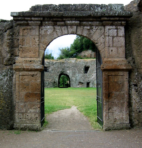
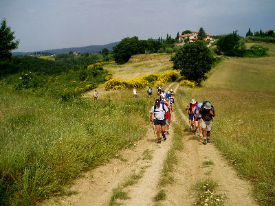
The Francigena Road
The Empire’s strength and development capacities were mainly due to this close network of road links, whose building and maintenance were controlled by the college of the curatores viarum. With the fall of the Empire, most of the system collapsed and fell into neglect as an effect of the downfall of a century-old political, military and social organization.
The state of neglect was obviously gradual and incomplete and did not affect those areas or roads whose importance remained unchanged, since they weren’t directly bound to the destiny of the Empire. So, we could say that the aphorism "all the roads lead to Rome" still remained partly valid, even though Rome was no longer the capital of the earthly power. In fact, the city had become the spiritual centre of Christianity and continued to attract all the populations living in the territories of the former Empire.
The Via Cassia and the whole road network north of Rome benefited from this change, since during the early Middle Ages, the centre of gravity of Europe’s political power had already moved to the north.
The Via Cassia was paved around half of the II century b.C., thus rearranging other pre-existing roads which were inherited from the Etruscans.
From Ponte Milvio in Rome, it passed by the statio ad Vacanas (the Baccano valley) in the territory of Vejo, where the via Amerina originated. Then came Sutri and Forum Cassii (S. Maria in Forcassi, close to Vetralla) as well as the Etruscan Sorrina (Viterbo).
Proceeding northwards, the Via Cassia crossed the thermal area of the Aquae Passeris, it climbed up the Montefiascone rise, moved down into the Bolsena Lake
caldera and then up again to the Alfina plateau, overcoming precipices, narrow ditches and many other difficulties instead of taking advantage of the comfortable ridge where the present State Road No. 71 (Umbro Casentinese) passes, to reach the areas of Orvieto and Chiusi easily.
All of this because the Via Cassia was necessarily meant to cross the most important roman town of the area, i.e Volsinii, forerunner of the present Bolsena. This settlement was the cradle of a flourishing Christian community and gave birth to St. Cristina. The worshipping of this saint gave a significant importance to the road of the medieval pilgrimage towards Rome.
After Volsinii, the Roman Via Cassia headed east towards Orvieto and then bent northwards along the valleys of the Paglia and Chiani rivers and through the territory of Chiusi up to Arezzo. From there, it turned to the west passing through Florence, Pisa and Lucca to join the Via Aurelia close to Luni on the Tyrrhenian coast.
Since the early Middle Ages, the part of the Via Cassia between Bolsena and Rome became the final stretch of a route which connected Rome directly to the regions of northern Italy and was used by kings looking for a papal investiture as well as by the crowds of pilgrims.
These pilgrims were men and women of all kinds, mostly coming from France and the Anglo-Saxon world.
They wanted to reach the Eternal City to strengthen their devotion, do penance or to make a vow, bearing witness of their faith to the tombs of the martyr apostles Peter and Paul.
This route traditionally connected Canterbury to Rome, but it had been interrupted, reopened, shortened or improved for hundreds of times.
Since the end of the first millennium, it was known as the "via Santi Petri" or "strata Beati Petri" or also as "via Romea", being the most important road leading to Rome, the heart of Christianity.
Nowadays the name "via Francigena" ("road of the Franks") prevails, although we should remember that in ancient books this term was used to indicate only the Tuscan
stretch of the route.
The layout of the Via Francigena can be reconstructed according to the description of places and settlements written by several remarkable pilgrims as a memory of their trip or as a memorandum for future journeys.
The most ancient and significant among these "baedekers" date back to the X – XIII centuries and they show how the route gradually changed during the ages.
The most famous is without any doubt the description that Sigeric, the archbishop of Canterbury, wrote during his journey from Rome between 990 and 994. We can find other precious information from the notes of the abbot Nikolaus Munkathvera from Iceland, written in the XII century during his pilgrimage to Rome and the Holy Land, or those written by Philip II August, King of France, who returned from the third crusade in 1191.